Lägern Ridge hike in Baden | The Half Trail
25|03|2020
Lägern Ridge hike in Baden | The Half Trail
Challenging | Lägern Ridge Hike in Baden | Superb trek in canton Aargau | Exposed ridge path
Die Fakten:
Ausgangspunkt | Baden Old Town | Covered wooden bridge
(There are several parking places within walking distance or you can simply take public transport and you don´t have to worry about that )
Endpunkt | Baden Old Town | Covered wooden bridge
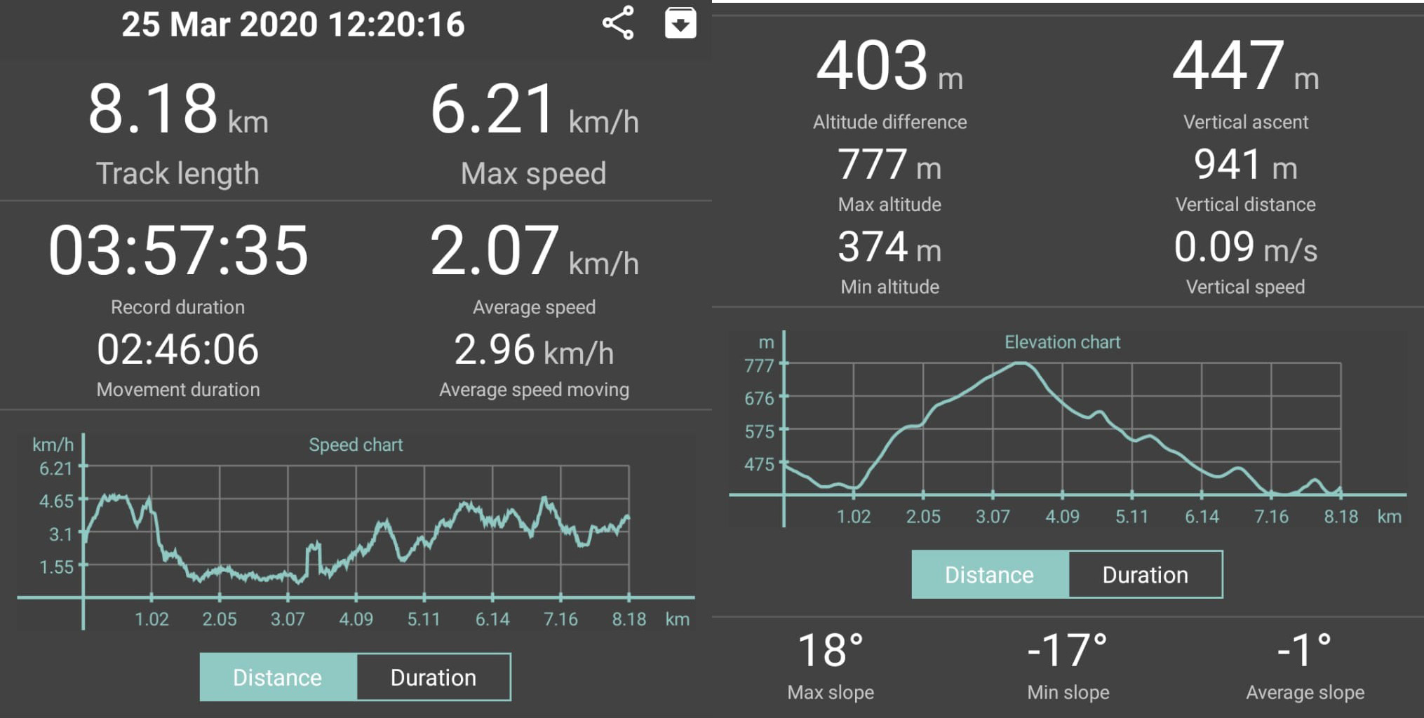
Reine Laufzeit | 2 hrs 45 minutes
Aufnahmedauer insgesamt | 4 hrs
Streckenlänge | 8 km
Aufstieg | 403 m | Abstieg | 403 m
Technischer Anspruch | moderate
Kondition | moderate
Beschilderung | provided 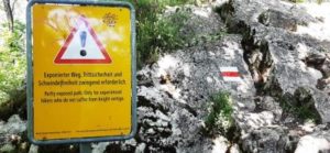
Are you afraid of heights? If the answer is yes, then this hiking route might not be for you. Are you looking for an adrenaline-rush-filled hiking experience, whilst staying in the greater Zurich area? If the answer is yes, then this route might just be right for you! The Lägern ridge hike in Baden can be described as either a scary trek or a challenging route for others or an easy-peasy walk for the experienced hikers. Whichever description hikers label this trek, it is definitely an unusual and unexpected adventure in canton Aargau for all of us!
The beautiful city of Baden
We started this hiking adventure in the beautiful city of Baden, in the canton of Aargau. This gem is located on the bank of the river Limmat. A small town with a huge charisma! It has been famous for its 18 mineral hot springs since at least the Roman era over 2,000 years ago. In fact, it is here in Baden, where you can find the most mineral-rich water in Switzerland.
Until the present day, the town continues to be a major spa location. In addition, due to the healing powers of the thermal water, the city was visited by no other than Goethe, Nietzsche, Thomas Mann and Hermann Hesse. If these gentlemen did not know what`s good, who does?
Apart from its vibrant history, the magical springs and a number of Swiss Heritage Sites to visit (e.g. the Roman city or the Ruins of castle Stein), the town captures you with its pure charm. Therefore, the Swiss often describe the city as “herzig” and that`s what it really and truly is – lovely.
We strongly recommend to check out the colourful history further on local websites or simply drop by and visit! We have made Baden our home town since last year and have never once regretted that decision.
In addition, Baden and the surrounding areas offer outdoor fans tons of local walking and hiking possibilities. These range from pleasant walks along the lively river Limmat to countless routes through the various adjacent forests. Moreover, the routes include almost everything an active-nature-loving person can look out for: diversity, memorable experiences, great views, as well as challenging ascents and relieving descents. There are also countless impressive landscapes, ready-to-use impeccable BBQ places and wild flower filled meadows. And lastly, for some of us, some scary stuff, such as the Lägern ridge hike in Baden.
Now, who or what on earth is Lägern?
Lägern, also spelled Lägeren (and therefore often leading to confusion amongst us two on how to pronounce it correctly) is a mountain. Yes, nothing fancy, quite straightforward, Lägern is a mountain. Surprise! We are in Switzerland after all and this blog is about adventurous walks and hikes in Switzerland.
The highest point of Lägern lies at 866 metres above sea level. Oh, isn`t that sky-scraping?
Considering that there are over 250 mountains in Switzerland with summits exceeding 3,600 metres above sea level, we can surely describe Lägern as a relatively small mountain. If you would place our Lägern beside the famous and glorious Matterhorn with its 4,478 metres, the “mountain” might shrink in the observer´s point of view to a mere “hill”.
You can probably feel that I am trying to belittle poor Lägern and you will soon learn where my sarcasm and antipathy originates from.
Lägern is part of the Jura mountains, stretching all the way from Baden to a city called Dielsdorf. The mountain is entirely traversed by a hiking trail following the crest. And that crest route is exactly what we came to check out today.
Afraid of heights?
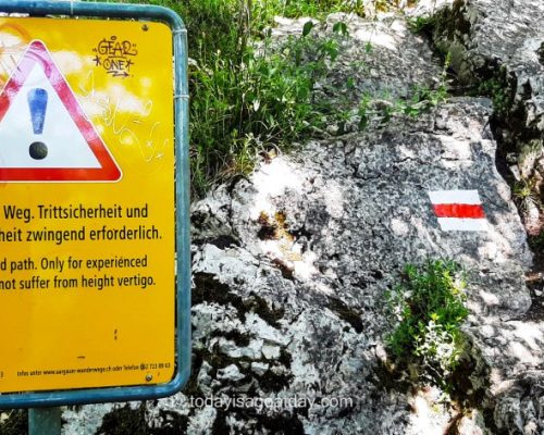
We have heard voices whispering of “vertigo”, “fear of heights”, “mountain hiking experience mandatory” and other slightly worrying attributes. We had also previously seen a bright yellow signage with a classic triangle warning sign. The sign is stating in German AND English: Partly exposed path. Only for experienced hikers who do not suffer from height vertigo. For some folks this sign might have said it all. For us, adventurous, daring, bold, always ready for the ultimate brave experience, this merely triggered our interest and thirst. We were ready for a new great walking experience in Switzerland. Yes, Lägern ridge hike in Baden, we can do this! Oh dear, in retrospect, I did not even know I was suffering from height vertigo before I met Lägern…
Schartenfels rock
But let´s start at the beginning. Once we had crossed Baden`s pretty old town and walked over one of the city´s most memorable sights – the covered wooden bridge – we arrived at the bottom of “Schartenfels”. Schartenfels is a dominant rock that nestles at the bottom of Lägern and marked the start of our ascent.
475 steps up to the starting point
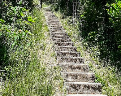
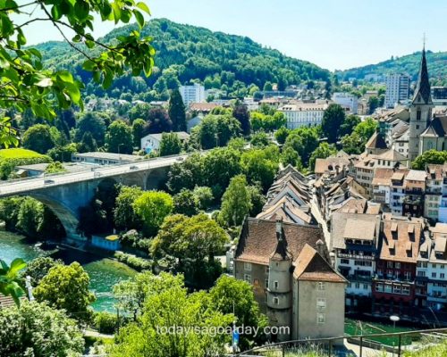
Firstly, before even starting the “actual” Lägern crest path one has to climb up no less than 475 steps. The starting point, with 252 steps, is a staircase along the Schartenfels rock. We have come up these stairs plenty of times to enjoy the great view over Baden, but that makes them no less exhausting. After having climbed up the stairs, first drops of sweat settled on our foreheads. Here, we took just a little moment to enjoy the view over the city we live in. The air was clear on this day in March, the temperature comfortable, the sun shining – an ideal day for a hike!
Secondly, it took a further 86 steps until we reached the edge of the forest. From here, another 137 steps through the forest led us to the top. In conclusion, it took us 475 steps to reach the actual starting point of this adventure!
On top, we arrived at Restaurant Schloss Schartenfels. The venue is castle converted into a pretty restaurant with a welcoming terrace and panoramic views over Baden and its neighbouring city Wettingen.
From here you can take off into four directions. To the left you can walk down the hill again and head towards the direction of Ennetbaden. Ennetbaden is another charming neighbouring town by the river Limmat. To the right, you can walk above the wonderful vineyards of Wettingen, located on a section of the Lägern`s slope. You can also explore more hiking routes through the adjacent forest or walk back down into Wettingen city. Straight on you can begin the ascent of Lägern`s crest. That was our direction today.
The different signages – from yellow to white-blue-white
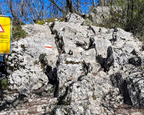
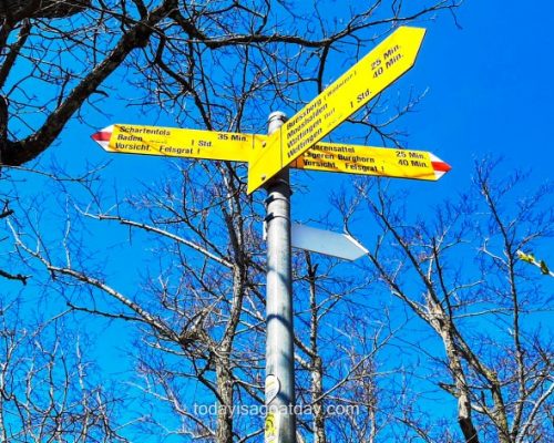
From here the path signage also changed from “yellow” to “white-red-white” – for a good reason. A full yellow sign means a walking path (Wanderweg), usually a relatively smooth path suitable for any walker. These trails can be walked without any special knowledge. The red & white stripes indicate a mountain hiking trail (Bergweg). A mountain trail is a more challenging route, which might be narrow, rocky, contain obstacles and may require special equipment. The mountain hiker must be able to correctly assess the dangers in the mountains. I asked myself, if after a year living in Switzerland, we would be able to correctly assess the dangers in the mountains.
If the answer was “yes” before this hike, the answer would most certainly be “no” after this hike.
There is a third sign marking walking and hiking trails in Switzerland, white-blue-white, indicating an alpine route (Alpinweg). An alpine route requires a very good physical condition, mountain experience, complete freedom from vertigo and steady-feet. Alpine routes lead through alpine, often pathless terrain, over glaciers or through rocks with short climbing points. Constructional measures are limited to securing particularly exposed areas with a risk of falling.
Before we even began the ascent, we were stopped by the previously mentioned bright yellow warning sign. Remember what I mentioned in a previous blog? “If the Swiss tell you the path will be steep, difficult and you should not suffer from fear of heights, then the path WILL ACTUALLY BE steep, difficult and you should DEFINITELY NOT suffer from fear of heights”. That phrase verified itself more than ever during the next three hours!
Off balance
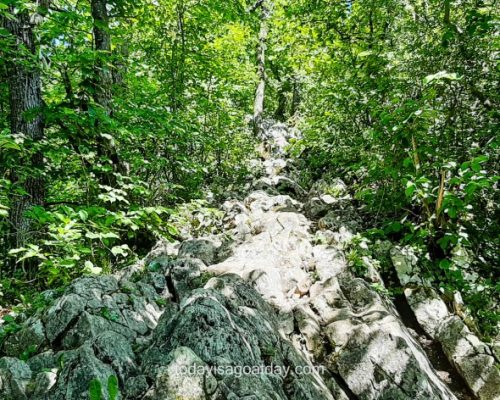
Regardless of the warning and our great knowledge of the Swiss signage system, we started climbing up. Immediately we felt that this hiking path, made up mainly of rocks and roots, enclosed by trees, required attention and caution.
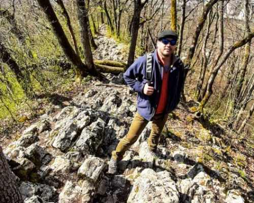
Despite the sometimes, narrow passages, however, the beginning was enjoyable and relatively “exciting”. We “just” had to watch our steps and place our feet mindfully and properly. This was the first time that I truly had to admit to myself that my steps were not half as secure compared to Krisztians´. Despite practising regularly Yoga, which includes a variety of balancing poses, I was very quickly thrown “off balance”.
The first mirror Lägern held right into my face, showcasing my own insecurity. I pushed away some worrying thoughts. Then I reminded myself that a few friends and neighbours had strongly recommended this hike. In addition, they had praised it as a great local adventure! What I forgot in that moment is, that these people were all Swiss. These lucky folks happily grew up in a world full of cable cars that rise up lightly thousands of metres. A world full of exposed ridge walks on dizzily high mountains, steep canyons and so on and so on. In other words, for them, “a challenging route” is something very different than for us, or rather me.
Risk of falling
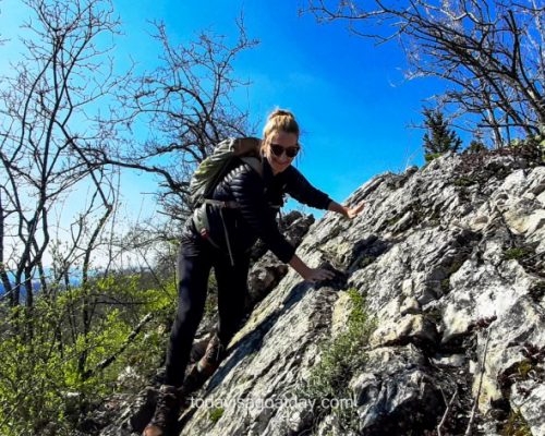
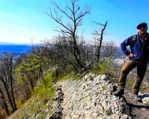
On we went, however, with no major occurrences other than the odd stumble on my end. After roughly 1.5 hours, we arrived at a part of the hiking trail where we actually had to hold on to the rock with our hands. The path had become terribly narrow. At that point I knew for sure that we were in actual risk of falling. At least, I was! Somehow, I managed, still trying to smile and pretending to enjoy this. Not in front of Krisztian, but to myself in order to boost my crumbling ego. We continued the ascent on the ridge. Now, the path became increasingly exposed and unprotected. More often the trees disappeared on both sides, opening up steep views into the valley. In conclusion, my worries grew uncontrollably with the exposure of the path and culminated in naked fear shortly after.
Attention. Rocky ridge!
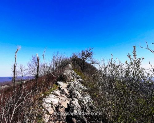
We passed another signage, stating once more “Attention. Rocky ridge!” EXCLAMATION MARK. We ignored the last chance to call this a day and simply descent back down.
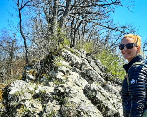
Slowly we moved forward, whilst the rocky ridge revealed itself. All of a sudden, we saw two hikers popping up from the other direction. After that, we decided to watch them “do it”. We also asked ourselves at that moment if people could actually walk past each other on that dreadfully narrow ridge. We doubted it. The two guys walked, almost pranced, so easily over the ridge, that it was rather annoying to watch. As soon as they arrived in front of us, we asked them how long this particularly exposed part roughly was. The answer: More or less 500 metres, about 15 minutes to walk. Alright, thank you. 15 minutes on an exposed ridge equals an eternity with countless opportunities to trip, fall and die. That`s at least how I looked this daunting phase, positively as ever!
On the ridge
Nevertheless, and only God knows why, a few minutes later we were on that very same exposed rocky ridge. I was as close as anyone can get to a mental breakdown. Krisztian´s worries had dissolved after having seen the effortless dancing on the ridge of the two guys (screw them!). My legs, however, started to shiver and sweat broke out uncontrollably. In conclusion, I started to curse Lägern, the two boys, goddam ridges and risky adventures in general! I simply could not take one step further. In fact, I had to sit down, clinging on to the rock and dear life, close to tears.
Well, that was a little lie. In fact, I started crying and it took a moment and a strong call from Krisztian to get me back on my feet: “Don`t do this now! Don´t freak out. Wait until I come back, then get up and slowly follow me back to where we came from”.
The end of the Lägern ridge hike in Baden
And that was the end of the famous Lägern trail. For a moment it was also the end of my self-confidence, as the feeling of “failure” settled in ruthlessly. Here Lägern had held another mirror right into my face. It was showing me that I actually was PETRIFIED of heights and definitely cannot cope with EXPOSED RIDGE WALKS. We slowly crawled back to the last signage, Krisztian took my hand – the mother and the whining child – and then climbed back down. The steep path led us away from nasty old Lägern ridge towards the much happier looking vineyards some 200 metres further down. It goes without saying that in my opinion this Lägern ridge hike in Baden deserves a white-blue-white sign.
Therefore, unfortunately, we are not able to tell you the whole story this time. As a piece of good news: If you are, just like me, afraid of heights, you don`t have to miss out on this one-of-a-kind hike. There is a harmless and much less challenging trail along the flank of Lägern mountain.
We sat down on a bench overlooking the vineyards, Lägern and this eye-opening experience in our backs, took a long breath in and a full breath out. Another time. Maybe.


